|
Short description
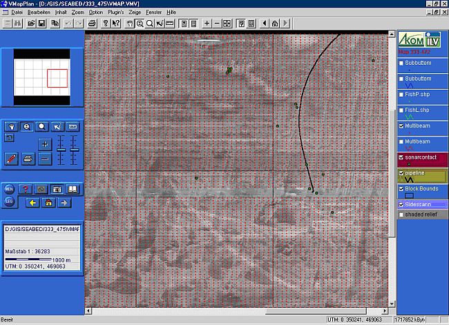
For future seismic investigations an area of 110 x 90 km had to be surveyed in decimetre resolution, using multibeam sonar, subbottom profiler, sidescan sonar and magnetometer including the appropriate navigation equipment. Potential obstacles had to be investigated for proper identification. The resulting data should be processed to create an accurate single GIS database for the entire Joint Venture Area. The project was started with concerted actions of 2 vessels. In the second project phase a single low draft survey vessel replaced the 2 vessels.
Project Duration
Preparation phase July 2001 to October 2004
1. Phase November 2004 to April 2005
2. Phase Mai 2006 to February 2007
Personal contribution
- preparation of bid documents, including:
- survey of equipment, available on the market, and investigation of its suitability,
- preparation of map materials and satellite imagery,
- technical inspection of different survey vessels worldwide,
- subcontractor relations worldwide,
- planning and calculations
- project preparation, including:
- subcontractor management
- preparation of survey vessel (ground survey for equipment calibration, HSE documentation, crew briefing)
- survey preparation (line planning, GPS reference data)
- Data and Report Managment, including:
- data handling,
- data stream filter programming,
- data QC,
- staff briefing
- daily, weekly and monthly reporting to the client
- map production, GIS implementation
- Deputy party chief, including:
- integration of English and Russian speaking crew
- organization and conduction of production meetings, HSE training, psychological motivation trainings
- handling of organizational, logistical, personnel and technical problems
- permanent client contacts
- Consultant for second project phase
- Problem handling with the knowledge of first project phase
- Client contacts
- Online Bathymetry Surveyor in second project phase
- survey configuration
- data acquisition
- data pre-processing
- statistical analysis
- data stream filter programming
- DTM processing for QC
Equipment used
Multibeamsonars RESON SeaBat 8101, RESON SeaBat 8125,
Sidescansonar Geoaccoustics (fish SS942),
Subbottomprofiler Geoaccoustics Geochirp,
Singlebeamsonar ATLAS Deso 25,
Marine Magnetometer G880, G881,
Sound Velocity Probe SVP 25,
Data acquisition work stations CODA Octopus 760, RESON 6042 (QINSy),
Navigation software EIVA Navipack, QINSy,
Data processing software RESON 6042 (QINSy), ERDAS Imagine, ADOBE Photoshop,
GIS software ArcGIS (ESRI), ERDAS Imagine, VmapPlan,
Programming tools awk, sed,
MS PROJECT, MS EXCEL, MS WORD etc.
|