|
Short description
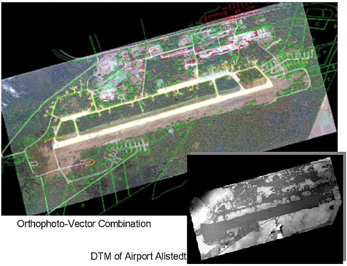
The client required a comprehensive survey of the airport and surrounding areas, necessary for an airport reconstruction and upgrade to a leading freight airport in Middle Germany. It was proposed to conduct an aerial survey with accuracies of better than 0,2 m in plane and height. A digital topographic database, containing ground control points, orthophoto and vectorized map information, was produced. Using special developed digital technologies the obstacle limitations were identified and highlighted in the topographic base data. Later this base material was used for modelation and assessment of different planning versions for technical, economical, environmental and financial aspects.
Personal contribution
- preparation of bid documents
- project management, including:
- aerial survey planning,
- subcontractor relations,
- permanent client contacts,
- team management (team of 3 engineers)
- data QC
- practical project implementation, including:
- aerial survey data processing (Aerotriangulation, 3D mapping, DTM derivation),
- development of project technology,
- implementation and testing of new developed technologies,
- 3D modelling of different planning versions and resulting site characteristics,
- map production for developed models,
- GIS based calculations and estimations of different planning parameters (terrain movements for runway extensions, tower positions and heights etc.)
Equipment used
- Ground survey equipment
- Stereophotogrammetric workstation SOFTPLOTTER (Autometrics Inc.)
- Modelling software 3D-Studio (AutoDesk), GeomView, Surfer
- MS EXCEL and other office software
|